
We did spend about a week in Dubois, WY. prior to Jackson.
The CG here is fantastic - we are set back from the road and backed up to the Wind River.


Our CG is in a valley and here are a few pictures of the surrounding mountains:


Here is a little history of Dubois:
Dubois (pronounced /ˈduːbɔɪz/ DOO-boyz, see below) is a town in Fremont County, Wyoming, United States. The population was 962 at the 2000 census, although it nearly doubles in the summer with many part-time residents.
A significant proportion of Dubois residents are writers, artists, photographers, musicians and songwriters, drawn to the remote town in part by its relatively moderate climate and remarkable scenery.
Sitting beside the upper Wind River, the town of Dubois in the heart of the Wind River Mountains is an unparalleled outdoors recreation center. It's a rustic town with a main street spread along Highway 26/287 containing false-fronted buildings, many made of logs.

And further on down the street was Mount Calvary Lutheran Church (which we went to on Sunday). There were 24 people in attendance, and, six of us were visitors!!!

Now, Dubois is a hub for guest ranching, and fishing and hunting expeditions to some of the best big game territory in
The town is mid-way between Riverton and Jackson Hole, via Grand Teton National Park , and makes a pleasant and somewhat rustic stop-over on the way to Grand Teton and Yellowstone .
We did quite a bit of sightseeing while we were here. These pictures are from a mountain overlooking the town.


They grow alot of alphalfa here and I think that is what was growing in this field.

We thought this was rather unique - a nice house up on the mountain and the tepees below.

We also took a ride of about 6 miles to the foot of Whiskey Mountain.

After the first couple of miles of decent gravel road, it turned into this (not so decent - top speed was about 15 mph):

A couple of nice, blue lakes were along the way. Would love to have cast a line in there, but fishing licenses in WY for non-residents are $16 a day.


We did see this sign along the road and thought we might get lucky and see one, but it didn't happen.

We had also read about bears, on one of the area websites:
The Forest Service has issued a BEAR WARNING in the national forests through the end of this summer. They are urging everyone to protect themselves by wearing bells and whistles and carrying pepper spray.
Campers should be alert for signs of fresh bear activity near their campsites and to that end should be able to tell the difference between black bear and grizzly bear dung.
Black bear dung is rather small and round. Sometimes there are berries, seeds, and/or small mammal bones and fur visible in it.
Grizzly bear dung is larger, has bells and whistles in it, and smells like pepper spray.
I think we found out later on that the weather has been very unusual this year in that it has been too warm (by about 20 degrees) so most of the animals have stayed higher up in the mountains where it is cooler. We did happen on to these animals, however:


The next couple of pictures attempt to show the fall colors in the mountains:


We drove as far as we could and then I walked up about 300 - 400 yards up the trail.


It was a beautiful day (as all have been) and we thoroughly enjoyed our trip into the mountains.

This was the prize at the top - glaciers:

Before we left Duboise, we had to have a couple of pictures of the town jackalope.

They like to have someone climb on this one and have your picture taken (but MOM wouldn't do it!).

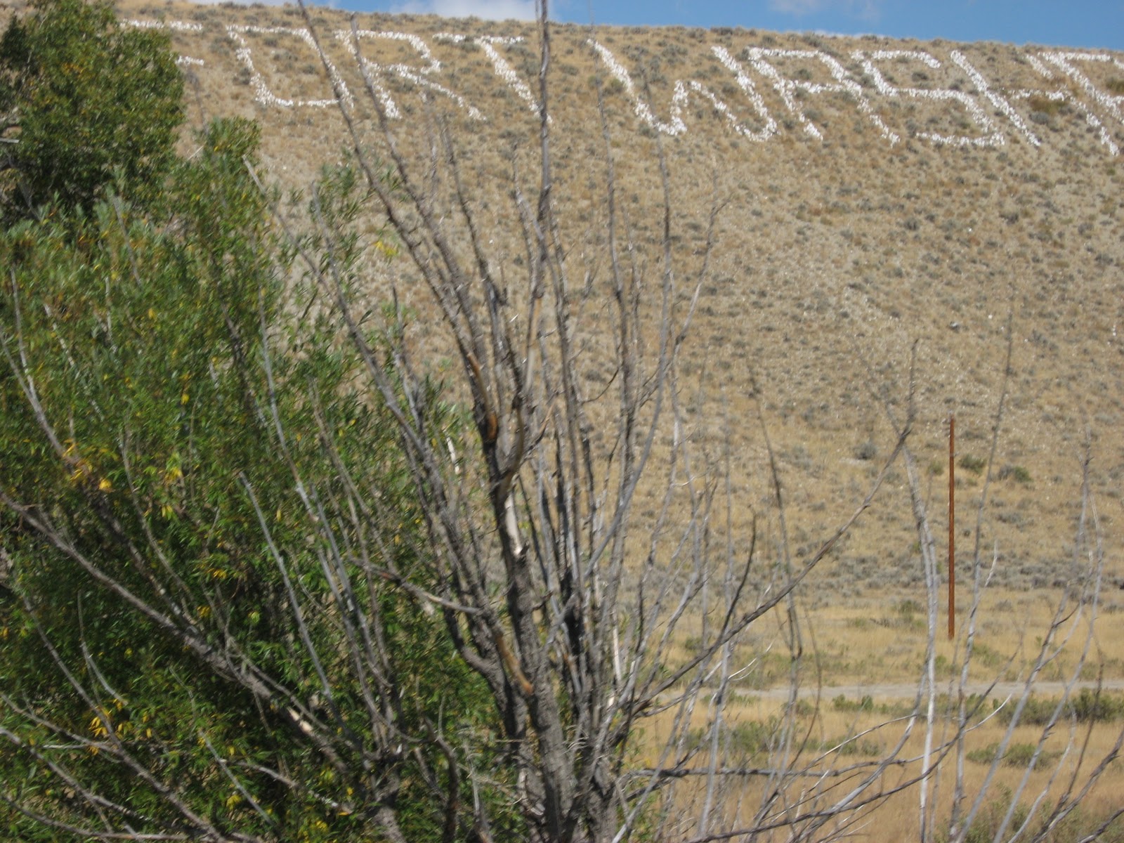
On our way from Dubois to Jackson, we did stop at Fort Washakie where they have an incredible Indian Museum.
They also have a cemetary where an Indian maiden, Sacajawea, was buried. She was the only female on the Lewis & Clark expedition and helped deal with the various Indian tribes during their travels. We tried to find her grave but the cemetary was too large.

The Togwotee Trail (which we followed to Jackson) winds along U.S. Highway 26-287 and is one of the country's most scenic roadways. Although the trail didn't officially open as a road until 1921, some speculate it was the northerly route of Lewis and Clarke on their journey back over the Rockies Togwotee Pass.
It has been more than 50 years since the roadway was last updated, and the Wyoming Department of Transportation (WYDOT) is making critical improvements to a 38-mile section of the Trail between Dubois and Moran Junction/Grand Teton National Park. The project will improve safety and reduce the frequency of landslides and wildlife collisions with motorists. Togwotee
We did make it to Jackson (Jackson Hole), WY and found our CG.
More in the next installment...
No comments:
Post a Comment