Thursday, October 16, 2014

Whitehorse, YT and Skagway, AK

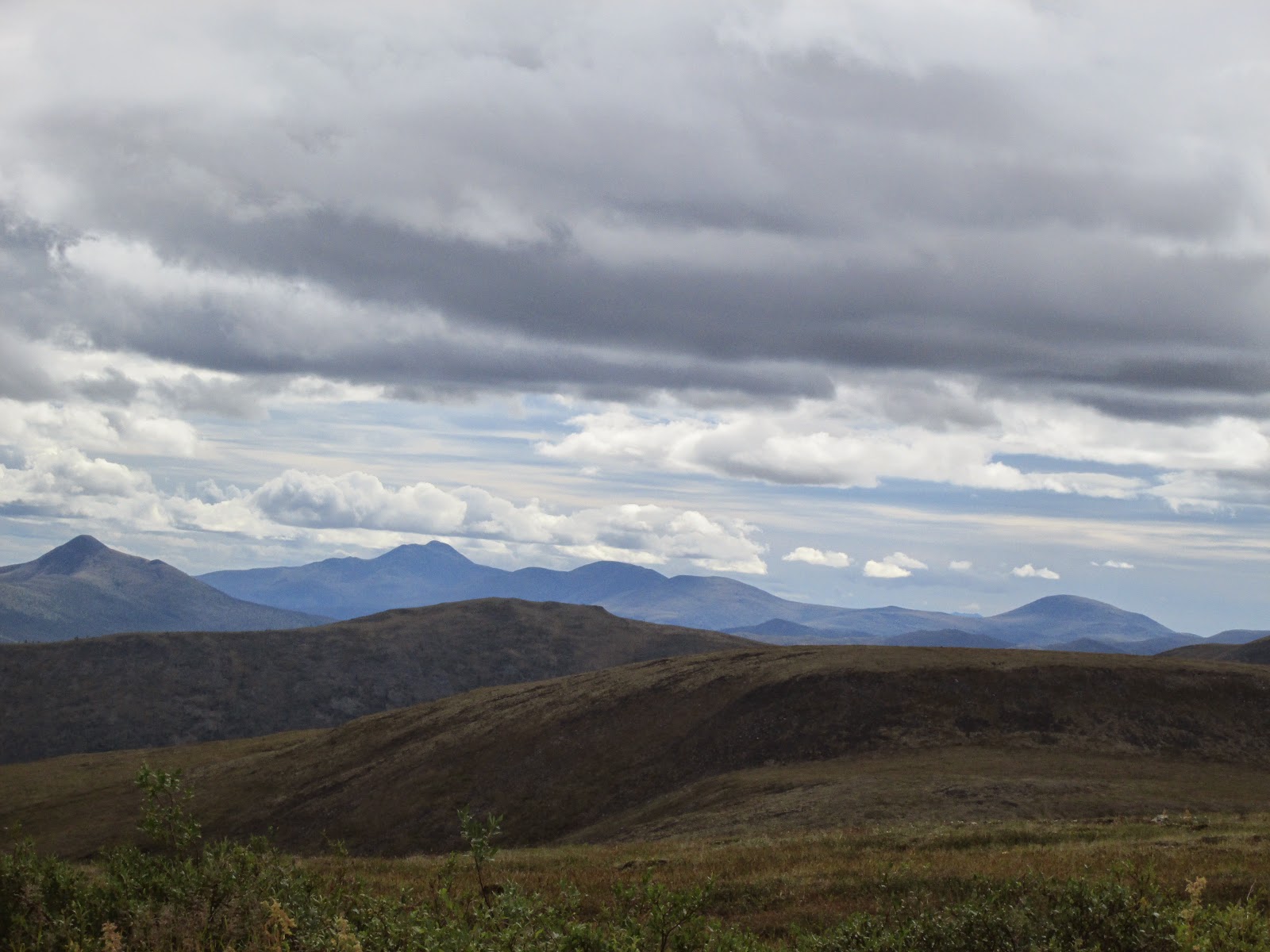
On Monday, August 18th we drove the Klondike Highway from Dawson City, YT to Whitehorse, YT (the capital of The Yukon).  Along the way we got good views of the Yukon River.  In this picture you can see what is called the five finger rapids.  When the early prospectors came thru here, they had to get over to the far right side to safely continue up the river.  If you went thru the left side, you would beach your boat.  If you went thru the middle, the rapids would take over and capsize your boat or raft.


As usual, very scenic along the way.


We arrived in Whitehorse, found our campground, and got set up for a few days.

Saw this bus in our campground:


Very interesting.  The back part of the bus is where everyone sleeps.  It is 3x3x6 feet. Looks like it could hold around 25 people.  During the day you ride in the front section that is just like a bus.  We did see them in Fairbanks as well and they were all out preparing a meal at their campsite.


On Wednesday, the 20th, the four of us took a tour to Skagway.  It consisted of taking a bus (right from our CG) to a town called Frazer.  We crossed the border from YT to AK where we boarded a train that would take us the rest of the way.


FYI - not our engine!!


The ride was very scenic as you can see.


In 1898, at the start of the gold rush, the prospectors' journey began here when they climbed the mountains over the White Pass above Skagway and onward across the Canadian border to Bennett Lake, where they built barges and floated up the Yukon River to the gold fields around Dawson City.  Others disembarked at nearby Dyea, northwest of Skagway, and crossed northward on the Chilkoot pass.
Officials in Canada began requiring that each prospector entering Canada on the north side of the White Pass bring with him one ton of supplies, to ensure that he didn't starve during the winter. This placed large burden on the prospectors and the pack animals climbing the steep pass.

The "Golden Stairs" were 1,500 steps carved out of the mountain ice.  Stampeders moved up the narrow stairs in a single line, clutching the rope balustrade, carrying their goods on their backs, 50-60 pounds at a time.  The workers who had carved steps into the ice also charged travelers to ascend the mountain, as the travelers had to use their stairs.  The term, 'stampede' was laughable in such crowded, slow-moving conditions.  A single trip up the "Golden Stairs" could take as long as six hours.


Miners climb Chilkoot.jpg


Our train continues drown thru the pass.


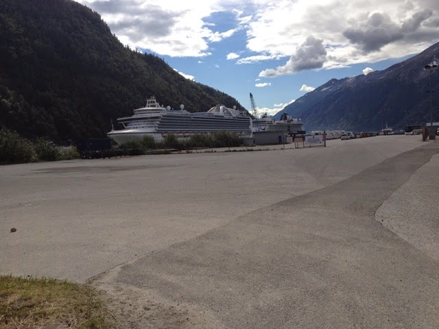
At this point you can see the Skagway harbor.


As we get closer, you can see the cruise ships.


An abandoned gold dredge along the way.


We reached the Skagway rail station.


One of the main streets in Skagway.


Cruise ship in the harbor.


HUGE!!


Two other shps across from the Norwegian.


Snow blower used to keep the tracks open.


We only had a couple of hours in Skagway so we had some lunch and then walked around some.  With 3 cruise ships in town, the streets were extremely crowded.

For the ride back to Whitehorse, we took a bus.  One of the stops was at a place called Carcross, so named because caribou originally crossed thru this area twice a year according to the prospectors who passed thru here.


It is now a popular stop for all the tours.  

We enjoyed this trip to Skagway and back.  If you ever get the opportunity to visit Skagway (via cruise ship, etc), you should definitely do so.

Chicken, AK

Unable to locate our pictures at this time.

We did have fun while in Chicken though.  We toured the old town which they hope to restore some day(?.
We panned for gold right there at the campground.  Some prospector brings a truck load of 'material' down from his claim and dumps it at the CG.  All you need is a pan, fill it with material, and sit along the river and find gold.  We all found a few flakes but not enough to amount to much.

We also drove over to another river to pan.  Took our chairs, shovels, pans, and did some panning there as well.  Didn't get much.

If/when I find the pictures, I will update this blog.

Dawson City, YT #2


On Sunday we decided to do some more panning for gold.

The gold rush started here in 1896 with the Bonanza (Rabbit) Creek discovery. It runs for about 20 miles from the Dome Mountain to the Klondike Rvier.  Bonanza Creek was the center of the Klondike Gold Rush, which attracted tens of thousands of prospectors to the creed and surrounding area.  Prior to 1896 the creek was known as Rabbit Creek but its name was changed by miners in honor of the millions of dollars in gold found in and around the creek.
During gold-mining operations, the course of the creek changed drastically.  It was heavily developed in the early 20th century, but was largely abandoned by the 1950's.  A handful of small gold-mining operations continue on the creek, but today it is best known for its historic value.
The Discovery Claim (#37903), a mining claim on the Bonanza Creek marked the development of the Yukon.  Dredge NO. 4 is a preserved bucketline sluice dredge used to mine placergold and is open as a National Historic Site of Canada on Bonanza Creek.  (Placergold is gold that has washed down the river and embedded itself in gravel/rocks since it is about 10 times heavier).


Here we are - panning for gold.


Unfortunately, we did not find any.  As stated above, this river may not be the same river since it has changed course many times during the dredging operations.  Also, this is a prime place where alot of people come to try their luck.

Here are a few pictures of some active mining still going on here.


Not a very good picture, but this is their dredge that they are using to separate the gold from the dirt/rocks,


Hated to leave Dawson City, but we still have more to see.

Dawson City, YT

We left Chicken, AK on Friday, August 15th and headed to Dawson City, YT. The drive to the border this time was much better as compared to 2011.  The road had extensive work this year.
At the border we stopped and took these two pictures of the welcoming signs.


The border crossing was a simple matter of answering a few questions and then we were on the way.  This is the  "Top of the World" highway so scenery was exceptional.


The road here was a combination of asphalt and gravel.  Always had to be on the lookout for rough areas.


This picture was taken as we descend out of the mountains and down to the Yukon River.  You can see Dawson City on the other side.


The ferry that will take us across the river.  Takes about 20 minutes each way.


I guess Fridays are a bad time to come this way because there was line of cars/RV's, etc. waiting to cross.  In addition, we found out later that it was Pioneer Days in the Yukon.  Took about 2 hours before we got down to the loading area. 
Here are our trailers (ours and Risbergs).


If you wanted to wait outside, there was this interesting seat.


We crossed over first and then the Risbergs were loaded.


Notice how much room (or lack thereof) there was.


We both made it across and did find our CG.

Because of the holiday there was a parade.


Some old cars...


At the visitor's center there were some young people putting on their costumes.  Here they are in the parade.


Many, many fire trucks and equipment.


This guy was showing off.


Looks like you could go off-road with this thing!


Beautiful flowers all around the town.


We went to the farmers' market and saw some beautiful vegetables.


Noticed this "home" on the river.


Dawson City was the center of the Klondike Gold Rush.  It began in 1896 and changed the First Nations camp into a thriving city of 40,000 by 1898.  By 1899 the gold rush had ended and the population plummeted to about 8,000.

Dawson City reminds you of an old-west town.  The buildings reflect it, the streets are gravel, and the sidewalks are wood boardwalks.


Found this interesting business.


I like the last statement on this sign:  "Tasty because you can't eat your gold."

We went to Diamond Tooth Gerties early Saturday evening to gamble some, eat dinner, and watch the show.


Like stepping into a classy Wild West saloon, Gerties' burlesque-lite show runs three times a night in summer.  It is the perfect way to remember Dawson's gritty but party-loving good old days.


Bob was 'lucky' to be selected to dance on stage with the girls!!


We drove up to Dome Mountain which overlooks the city and the Yukon River.


We found that a couple of people were using the mountain to hang glide.


They were in the air a long time before landing in the town near the farmers' market.

Dawson City is a great place to spend some quality time!

More later....