Monday, May 30, 2011

10th Canadian Stop - Whitehorse, YT

We were in Whitehorse, YT for a few days.  Largest city in YT with 26,000, which is more than half the people in the YT.  Nice town with everything you need.
We passed thru more mountains on the way here: 


And, just north of the town of Teslin, there was a Tlingit Heritage Center that highligts 200 years of Inland Tlinglit history.  We did not go in but they did have 5 outdoor totems representing Wolf, Eagle, Frog, Beaver, and Raven.  Here are two of them:


We crossed over the longest bridge on the Alaska Highway in Yukon Territory at Nislin:

We found our CG just east of Whitehorse, got setup, and then drove into town to get the lay of the land.
On Friday night, we went to dinner at the best restaurant in Whitehorse (according to their advertisement) and had ribs and prawns - both were excellent.  Quite impressive, isn't it?

After dinner we walked around the town for awhile until around 8PM when we went to a Frantic Folies show which was a ‘Gay 90s” review featuring high-kicking Can-Can girls , hilarious skits and rollicking good humour (as the brochure says) and it was!


On Saturday we took in the sights: saw a 'log skyscraper' (Yukon's first highrise):

 and an old log church (the original Anglican Church that now houses a museum describing the introduction and spread of Christianity in the Yukon):


We toured the S.S. Klondike, one of the largest sternwheelers to travel the Yukon River:

We started at the lowest level and worked our way to the top - the guide was extremely knowledgable.


This was down below where all the controls were:


Only 1st class passengers could be in here:


The lower level of the ship was loaded as if it were still in operation:


 After we left the boat, we went to the Yukon Brewing Company for a tour, but found out that they do not give tours on Saturday.  So we did the next best thing - bought a couple  of beers for later.  They were very good.
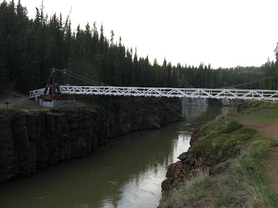
On the way back to the CG, we walked down to Miles Canyon and crossed the suspension bridge:


There are alot of trails that you can follow from here (we didn;t):


I think that about does it for this day.

Wednesday, May 25, 2011

9th Canadian Stop - Watson Lake, YT

We left Toad River RV Park on Tuesday, the 24th and drove north in beautiful sunshine! 
This is another picture of the snow on the mountain behind our campground site, only from the road and without clouds:


We got into the curvy up and down roads thru the Western Rocky Mountains again.  Scenery, of course, was beautiful.


We came to the Muncho Lake area and had to stop for diesel (forgot to do it at Toad River).  We paid dearly since this was a very touristy area along the lake with a huge lodge and even a CG along the lake.  Cost of diesel was $7.00 US per gallon!  Campground sites started at $49 per night! 

The lake was still frozen in many places:


The lake is known for its deep green and blue waters.  The mountains surrounding the lake are approximately 7,000 feet.


Further up the road we came to the Laird River Hotsprings Provincial Park. 


You pay $5 per person to enter and you can either camp overnight (no hookups) or you can just park in the day-use area, which we did.  The purpose of stopping here is the hot springs.  A boardwalk which leads to the pools crosses a wetlands environment (reminded us of Yellowstone). 


There are two hot springs pools with water temperatures ranging from 108 degrees to 126 degrees.  Here we are:


We spent about 30 minutes in the water and then got back on the road again. 
Along the way we were warned by “The Milepost” book and signs along the road to watch out for wildlife. 


Well, we have seen those signs so many times before and never got to see much so we weren’t really expecting to see anything.  But, lo and behold, here they are:


We got a pretty good look at this black bear - most of the time we couldn't see his head, but he did come up for air once!
We finally made it to Watson Lake around 3 PM and got checked in and set up for the night.  Most CG’s have cable TV hookups, and, we found out something very unusual with it.  We wanted to watch Oprah so we asked what channel it would be on.  They said they would turn it on for us.  And we got it.  Last night we wanted to watch Biggest Loser so they told us to turn on our TV, and, while we watched the screen, we saw the TV guide come up and saw him searching for the correct channel (370), and then he locked it in.  After the show was over, we tried to go back to channel 370, but it was no longer there(STRANGE!!).
Wednesday we went to the Signpost Forest.  It was started in 1942 when a US soldier working on the Alaska Highway was homesick so he erected a sign.  Since then travelers have been adding signs to the collection, now more than 70,000!!  AMAZING.


Of course, we had to make our own sign:


We also went to the Northern Lights Centre, the only planetarium in North America featuring the myth and science of the northern lights.  It was good.

Tomorrow we leave for Whitehorse, YT and expect to be there thru Monday.

Will post more later…

(Jim, the roads have been very good so far.)

Monday, May 23, 2011

7th & 8th Canadian Stops - Sikanni Creek and Toad River, BC

Sunday morning, 5/22, we left the Sikanni Creek CG after having spent the night there.  It was not your ideal CG by any means but it was an overnight stop for us.  (We actually saw this guy on Saturday on the way to our CG):


This is the Alcan Highway north of Dawson Creek - pretty good road.


This was the start of our descent down to the Sikanni CG.  The Milepost book we have said to watch for the CG or you will blast right past it!


See how we are stacked in:


And wet grounds as well!!


The rear of our trailer can be seen on the left.  Only 3 of us in the full hookups section.

We did have sun after we settled in so we took a walk along the river. 


The CG was actually quite crowded because of the holiday weekend - for the Queen's birthday.

After we left, Sukanni, we drove north and encountered rain and fog almost immediately.  The fog was intense - could only go about 45-50 MPH.  (Somewhere I read that sunglasses would difuse the glare, so I put mine on - And it did!!).  We went up into the Western Canadian Rockies and had numerous 8 - 10 % grades up and down, but they were not a problem.


The road thru the mountains was not as good, and, there were many signs about rock slides. 


This picture doesn't show it, there were a couple of areas where we actually had to swerve around rocks on the road (all relatively small, thank goodness!!).

We found the Toad River RV Park and got settled in at site #17 which backs up to Reflection Lake, and, again, mountains in the background - a beautiful site.


The CG office is really a small restaurant, and, it must be good cause there is a lot of traffice around the dinner hours.  I found this on the internet and thought it was quite interesting:

There are many stories of how different places got their names along the highway. We kind of liked this one about toad so we've adopted it. Back around 1942 when the Canadian and us armies were busy building the Alaska highway (it was not the super highway you just drove in on) there were problems crossing the river, what with no bridge yet built, so it was par for the course to be "towed across". The proprietors of this establishment at that time adopted "Towed River" as the name of their lodge. Did someone really think they meant "Toad" or were their language skills lacking? Your guess is as good as ours at this point. So that's our story and we're sticking to it, for now anyway.
The hat collection began in 1979. One evening after a stressful day at the lodge the proprietors, could be the same two mentioned above, were having a brew or two. One left to see a man about a horse and the other tacked his hat to the ceiling. There you have it, doesn't take much to get something started around here. At the time of this writing there are over 5000 hats from all over the world. Do not leave your hat unattended!


We are here for two nights and then will head north (what other direction is there??) to Laird Hot Springs.