On Tuesday morning at about 8 AM we left Deadhorse and drove south on the Dalton Highway, which is a rough, industrial road. (If you were to rent a car in Fairbanks, you would have to sign a statement that you will not drive the Dalton Highway!!).
We eventually passed thru the Brooks Mountain Range which goes from west to east (most mountain ranges flow north to south). When you hear someone talk about the North Slope, it basically means the area from the Brooks Mountains to the Arctic Ocean.
The road south was either asphalt or gravel. The gravel, although noisier to drive on, was actually better because it was solid whereas the asphalt had dips and deep groves. Our average speed was probably no more than 40 MPH.
Trucks have the right-away on the Dalton Highway so when one would come up behind us, our guide would use his CB radio to let the trucker know that we were getting over for him.
The truck that was passing us in the picture above actually had another tanker trailer behind it with 5 axles.
When we would meet trucks, we would slow down and try to get over to give them plenty of room. Our guide would put his hand up on the windshield after the truck passed – he said that if a rock hit our windshield, his hand would take some of the blunt of the rock and maybe not break your windshield. We never had one hit, but he did it every time, just in case.
The landscape on either side of the road was pretty boring for some time. The perma frost below the surface never thaws so the top layer of tundra is fragile, not deep rooted.
If you look close, you can see the pipeline, follows the road most of the way. It travels 800 miles from Prudhoe Bay to Valdez.
Another picture of it here.
The pipeline is above ground whenever the perma frost is present because they can't dig thru it. And, later on in our trip, we would see it go underground and then back up again.
Along the way we saw ducks and geese.
And caribou...
Numerous times throughout the day we would see where the pipeline would go underground for approximately 50 yards and then come right back up again. Our guide told us that when they were plotting out the pipeline course, they were concerned that the wildlife would not be able to migrate from one area to another due to the pipeline. So they purposely put it underground in certain areas so that the animals could cross over. However, they later found out that it didn't really bother them at all. They even saw caribou crawling under the pipeline and their antlers were scraping the pipe!
Now, tell me, do these caribou seem at all concerned about the pipeline?
When they built the pipeline, they also built 12 pump stations along the way to keep the oil flowing. Four stations were built on this side of the Brooks Mountains and eight on the other side. Pump station #4 was the biggest because it had to pump the oil over the mountains. Pump #5 on the other side of the mountains had to slow the oil down.
This was pump station #1.
More scenery along the way. This pond was still partially frozen.
The Brooks Mountains are now off in the distance and we will have to travel thru them later in the day.
Around 12:30 our guide mentioned that he had a good spot for us to take a break for lunch. We traveled down this road and on the other side of that water, there was a side road to a small stream where we could eat.
The side road was the roughest road we were on during our entire trip, but it was worth it.
After lunch we hunted for fossils and found some.
We also found a few other things in the sand including this bear paw print. That's my shoe just to the right of it (almost stepped on it!), and, that's the toe of Judy's shoe on the bottom left as she took the picture!
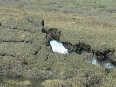
We also saw evidence of the perma frost when the ground cracks open due to the rain and sun.
As we continued south, the pipeline was at our side
We are now approaching the mountains. Note the road - not very wide most of the time.
We did find Dall sheep on the side of the mountain. Actually very low for them; they are usually high up on the mountain where the wolves can't get them.
More scenery as we get into the mountains.
About mid-afternoon, our guide said he needed to stop and take a break from driving. We came down this road (from top to bottom) and just after going thru this pass, we came to a turnout.
Most of us climbed this embankment to get to the top and take this picture of the van down below. Just look at the valley between the mountains - takes your breath away!
This plateau is what we climbed up to and took our pictures.
Later on in the day, we got thru the mountains and to the south side and started to see green in the landscape. We stopped to take a picture of this spruce tree which, as the sign says, is the farthest north spruce tree. But someone decided to be stupid and cut all the way around the lower part of the tree trunk and now it has died. Luckily there is another new spruce tree growing just a short distance away from this one.
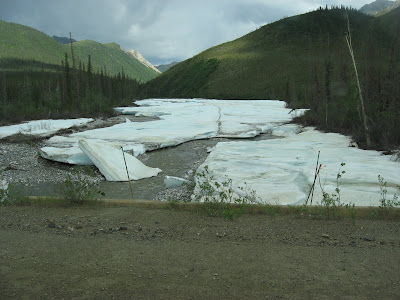
During the day we have seen numerous streams/rivers that are still iced over. We stopped at this one because you could really see how thick the ice is.
And, being the adventurers that we were, we went out on to the ice for pictures.
Vivian fell getting on to the ice so Ted opted not to be with us!
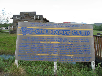
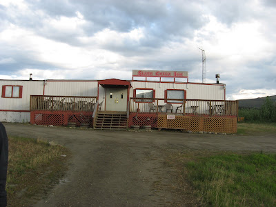
Our trip today covered about 200 miles and ended at the town of Coldfoot about 6 PM. Coldfoot was the original gold rush town – it got its name in 1898 when early prospectors reportedly got “cold feet” and left before winter set in. Now it is essentially a truck stop with fuel, a restaurant, motel, and a Ranger visitor center.
The scenery was beautiful the entire trip and the weather cooperated as well. We did have a small rain shower just before we got to Coldfoot so we had a rainbow over our motel when we arrived.
Accommodations in Coldfoot were better – we actually had a sink, and a bathroom with a shower – all in our room!
This map shows the highway that we took from Deadhorse to Coldfoot and the rest of the route that we will take tomorrow.
Day 3 later...


No comments:
Post a Comment